
Serving Midwest Aviation Since 1960
Serving Midwest Aviation Since 1960
Here's How A Subspecialty Developed To Guide Aircraft
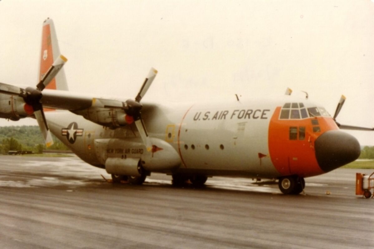
Flying with a C-130 squadron in Alaska included regular routes in the high Arctic, often between Thule, Greenland, and Anchorage.
Pan American Airlines hired Charles Lindberg to survey overseas routes in a Lockheed float plane called the Sirius. Ann Morrow Lindberg served as navigator.
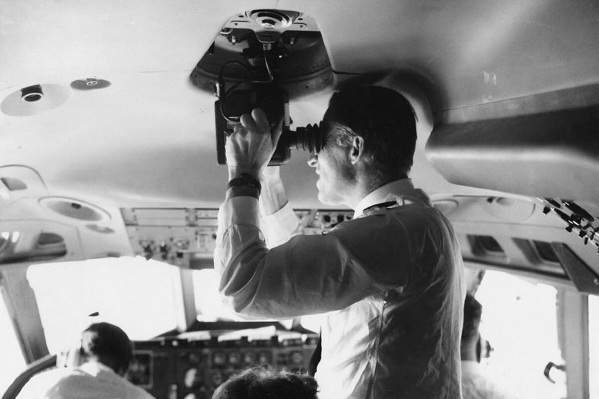
This Japan Airlines navigator is pictured using a periscope sextant in the early 1970s.
Ann Morrow Lindbergh (right) would have been the first person trained specifically to be an airplane navigator. She used a "bubble sextant" for celestial fixes. Charles and Ann were always able to find their position.
This bubble sextant is very similar to the one Ann Morrow Lindbergh used. Similar units were used in aircraft until the 1950s.
Periscope sextants were common in late 1950s.
Once there were navigators. Not a touchscreen gizmo made by Garmin or the weirdly mutated creatures that got hyped up on drugs to guide the Spacing Guild ships in Frank Hebert's novel "Dune."
Actual human beings once practiced their art using "dead reckoning" and celestial navigation. In the 1930s a subspecialty evolved to guide aircraft over the earth.
Charles Lindbergh found his way across the Atlantic using the compass and clock technique very much like that taught to beginning flying students. No check points, though. He did well and crossed the Irish coast about 3 miles from where he intended, but he was lucky.
During Lindbergh's trip the pressure pattern over the Atlantic was such that the net wind drift was zero. Lindbergh knew something better was needed, so he enlisted the help of a U.S. Navy Commander named Phillip Van Horn (P.V.H.) Weems.
Weems perfected most of the techniques needed for aerial navigation, but he was not a pilot. Lindberg learned celestial navigation from Weems, and they flew together several times. While still in the U.S. Navy, Weems started a civilian navigation school and hired Harold Gatty to do the instructing. An Australian, Gatty was also working on the air navigation problem. He and Weems worked out an aerial navigation system which Gatty taught to Ann Morrow Lindbergh.
Pan American Airlines hired Lindberg to survey overseas routes in a Lockheed float plane called the Sirius. Ann Morrow Lindberg served as navigator. She used a "bubble sexton" for celestial fixes, and the pair were always able to find their position.
Pan Am contracted with Weems and Gatty to train their navigators and in turn the U.S. military's first aerial navigators were trained by the airline.
By the 1970s, navigators were being replaced by "thinking machines," but still guiding airplanes on flights over the poles or oceans. I got interested in celestial navigation because I was lazy and later scared. When I was an impressionable youngster, my dad was a construction worker and would occasionally take me to work with him. One of his coworkers asked me if I wanted to do construction work when I grew up, and I said. "Oh yes, please."
Pop pointed at somebody dressed like the workers but with clean clothes. He said, "That guy's an engineer. He hangs out at the construction site but doesn't have to do any work." So, I decided to be a civil engineer. That was the lazy part.
One of the required courses for civil engineering back then was surveying and we learned to determine where we were using the sun and stars. Our instrument was a transit, not a sexton, but they functioned the same. I graduated in 1967 when the reality of the Vietnam war and "selective service" meant I was going to spend some time in the military.
I was surprised after a physical exam and written test when the Air Force recruiter said, "you qualify as a pilot or navigator." Thinking my surveying course put me halfway there I said I wanted to navigate, but the recruiter said the way it worked is you started training as a pilot. If that did not work out, you go to navigator school. No wonder navigators were under appreciated.
Later I flew with a C-130 squadron in Alaska. On long flights, the other pilots seemed content to drink coffee and BS while the navigator told them where to go. We regularly flew in the high Arctic, often between Thule, Greenland, and Anchorage. In the 1970s the "great circle" for that flight went over the magnetic pole making navigation interesting.
On a dark night in February one of our navigators messed up a fix and got lost over Ellesmere Island. The next sun rise was in March. They were flying over a solid cloud deck, the sea ice made the radar return useless, the compass was unreliable, and the navigator was still trying to figure out where he made the celestial navigation mistake. After wandering around for a few hours, the crew got lucky and found the airport at Frobisher Bay. That was the scary part.
That incident inspired me to learn more about what the navigator did. A week later I was deadheading on a flight over the Thule/Anchorage route. Our navigator was an "old head" major (maybe he was 35) and I talked him into teaching me.
We started with the stars and for the next 6 hours he showed me what to do.
With the transit, you took the star angles then did the calculations to establish your position. The calculations took about 10 minutes using tables and curves which was OK when nothing was moving. It probably worked on ships, too. An airplane moving 5 miles in a minute needed something different which was "pre-calculation." Star angles were calculated for a point ahead then observed with the sextant at that position. If the angles were as calculated the aircraft was on course. If not, a correction was made, and another set of observations taken.
Aircraft once had an "astrodome" for taking observations. In the C-130 the sexton was mounted to a periscope like device that was pushed through a small port with a valve on the ceiling of the flight deck. The observations were made, then the sexton removed, and the "sphincter" was closed.
When the sextant port was opened the pressurized air was sucked out through it. It was about the same diameter as a vacuum cleaner hose, so having one of those allowed us to turn the cockpit debris from a long flight into air pollution. I was on one flight where the pilot was smoking some awful smelling cigars and the navigator used the vacuum hose to dispose of the fumes.


Reader Comments(0)